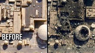

Does a viral image accurately depict damage to a U.S. installation in Bahrain after a drone or other strike? No, that's not true: Though there were news reports of several strikes in the area, the viral before/after image contains several inconsistencies. The image showing damage to a white dome and other buildings appears to show several extra structures that were not present in the "before" picture.
An example of the image appeared in a Facebook post (archived here) where it was published on February 28, 2026 without further description.
This is what the image post looked like on Facebook at the time of writing:
(Source: Facebook screenshot taken on Sat Feb 28 21:49:55 2026 UTC)
The image on the left corresponds with a location in NSA Bahrain visible on Google Maps here (archived here). On February 28, 2026 missile and drone strikes were indeed reported in the area.
Lead Stories overlaid both images on top of each other, using the structures in the bottom left corner as a guide, and turned them into a little animation.
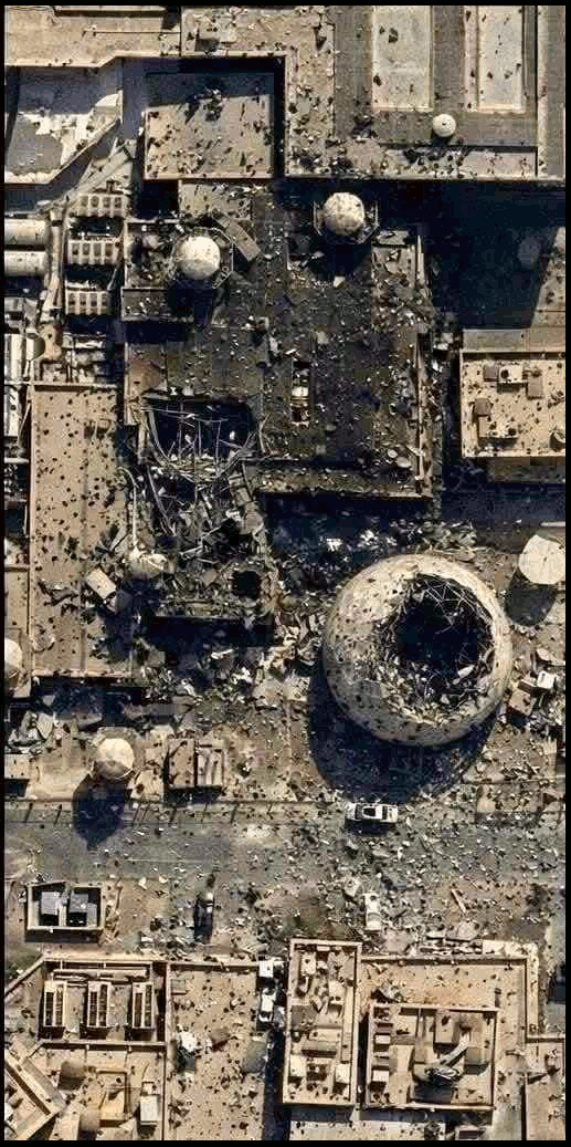
The bottom section of the picture shows a building with a nearly flat roof at the bottom but in the "after" picture there are suddenly two extra structures sitting on top of it.
The buildings at the top of the picture have also changed shape and differently shaped solar panels have been added to the "after" picture as well.
If the pictures were taken months or years apart it would certainly be possible for some of the buildings to have changed, but in that case the same vehicles wouldn't be present in both image in the exact same locations.
The addition of extra structures is inconsistent with damage caused by explosions so the "after" picture is fabricated, possibly with digital editing tools or artificial intelligence.